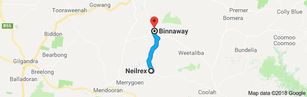
Drive to a Railway Town with Cinematic History – Binnaway

Binnaway

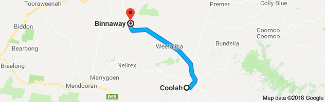
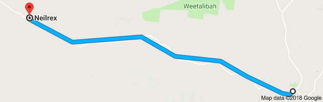
Journey time to Binnaway is approximately 43min / distance 57km, one way.


Start on your journey to Binnaway by heading north from town on the Black Stump Way.  As you are leaving town, just opposite the fuel station is a sign indicating that the Jimmy and Joe Governor passed here on the night of Sunday 5 August 1900, just prior to robbing P R Schiemers Hut at Mt. Angle and then trekking over Pandora Pass.

Continue on the Black Stump Way and you will cross Queensborough Creek.  Queensborough Creek is 24 km long and runs into Botheroe Creek towards the west.   It is also the name of a hill, trig station, parish and a park in Coolah as well as a large property that was initially part of the huge holding of Butheroe owned by James Vincent in the early 1800s.

A few kilometres further on, on your left, you may see the property Baladonga.  This property has a handsome stone homestead built about 1880.

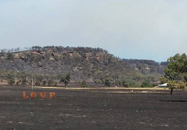
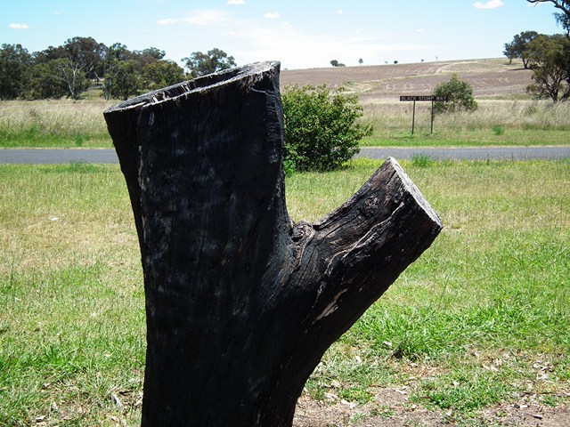
Next, cross Black Stump Creek, and on the right will be the Black Stump Rest Area, complete with a replica black stump.    Coolah lays claim to the saying “Beyond the Black Stump” as this was the approximate location of the Black Stump Run and the Black Stump Wine Saloon – a staging post on the old Sydney stock route before entering rough country.   In 1829, one of the limits of location or settlement was along the Black Stump Run.  Settlers did not strictly adhere to this boundary and often let their stock graze “beyond” and vaguely described them as “beyond the black stump”.   The Black Stump Wine Saloon was established in the 1860s and was destroyed by fire in 1908.   The Black Stump Cemetery, located on private property has two known graves dating from 1873 and 1874.

The Black Stump Rest Area

Continue on the Black Stump Way and then turn left on to the Warrumbungles Way.  There are a number of large farms, some of which are hidden behind the scrub that lines the road.   Eventually you will come to the locality of Weetalibah, first grazed by William Lawson in 1829.   In 1839 the Weetalibah runs totalled 48000 acres and carried 7000 sheep with six people living there.  Bushrangers made an appearance here around 1850 – three Chinese bushrangers had killed a settler and were seen at Weetalibah before being caught.    The first wheat sown in the district was believed to have been at Weetalibah in 1880.

Further along you will see Ulinda to the right. Although you can’t see it from the road, the property Ulinda has a homestead dating from about 1885 with twenty two rooms.  In 1910 the house was set in 1 and ¼ acres of garden and the property comprised 40,000 acres and contained 20,000 sheep and 200 cattle.   The woolshed is made or iron with twenty stands and in its heyday about 1000 bales of wool a year was shorn within its walls.

Just before you reach Binnaway you will see the Castlereagh River on your left.   This River is 566km long and was named in 1818 by Oxley after Lord Castlereagh, Secretary of State for the Colonies.   The River rises 20km west of Coonabarabran and flows eventually into the Macquarie River, 65km from Walgett.

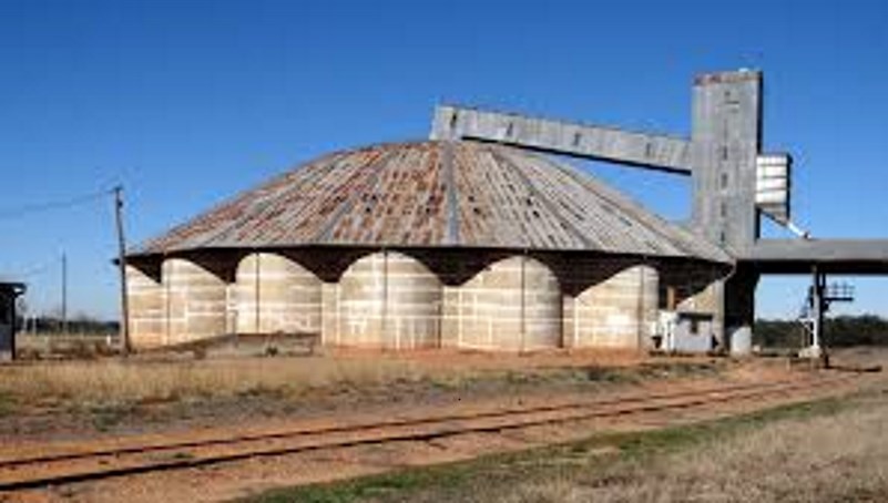
As you enter Binnaway you will see the large domed Silos (circular concrete silo type A191) on your left.  This more unusual style of silo (although a similar one exists in Gulgong), it has a capacity of 19100 tonnes and was built in 1955.

Binnaway Silos

Binnaway appears a sleepy little town to the passer by, but behind the scenes it is populated by an energetic community and is definitely worth a stop to investigate more.

The name Binnaway is believed to have come from either the aboriginal word “binniaway” meaning peppermint tree or from an early run situated nearby called Benneway.  Whilst pastoralists held runs in the district in the early years (William Lawson was one of the first), after the Robertson Land Act in 1861 selectors came searching for their 40-320 acre lots of crown land that they purchased at 1 pound per acre (a quarter of the price paid up front and the balance, plus interest, paid “at the selector’s convenience”).  Charles Naseby was the first settler in 1869 buying 50 acres, later extended to 100 acres (this land forms part of the southern end of the current town) and the “private” village was laid out on his land in 1876.

The access to the town has thankfully been improved with modern roads – in 1886 the only way into the town was through a ‘black sticky bog of considerable depth’ or ‘down and up dangerous, precipitous tracks’.

During the 1920s Binnaway was a bustling railway town acting as a vital transport link ferrying timber, grain and iron ore from rural NSW to coastal markets.   At its peak, over 20 steam locomotives would come through the town.  When diesel overtook steam in the 1960s much of the steam infrastructure was not needed and by 1975 passenger services ceased.   Binnaway is now a terminus of the branch line and has limited use. A railway signal tribute has been erected in the main street to celebrate the town’s association with the railway.

Binnaway’s claims to fame are: it was the location for much of the film ‘The Shiralee’ made in 1956 starring Peter Finch; local boy Jack Renshaw became NSW Premier (1964-5) (the main street is named after him) ;  and was home to Frank Bourke’s famous White Rose Orchestra.

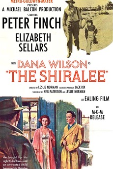
The Royal Hotel on the corner of the main street (Renshaw Street) was built in 1918.   This hotel appeared in the movie The Shiralee with Peter Finch and when it was open, prior to 2020, had a small “hall of fame” open to the public that featured movie memorabilia related to the film.

The Railway Heritage group is very active and plans are underway for a Rail Museum.   The Binnaway Railway Barracks (the original 1925 railway accommodation for railway workers) offers budget accommodation – twin rooms with share bathroom, communal kitchen, dining and BBQ area as well as a self contained flat that sleeps 2-4.  If you are interested in a stay here see their facebook page “Binnaway Rail Heritage Barracks”.

Another favourite place for travellers is the Pumphouse Camping Ground on the Castlereagh River on the north end of the town.  You can see the old pump house that used to supply the township with water from the Castlereagh River.

The Peppermint Tree Craft Shop has souvenirs, craft items, local honey, a book exchange and more.  Manned by friendly volunteers from the Binnaway Progress Association they are more than happy to direct you to places of interest around town.

The town also has the Exchange Hotel – a traditional country pub offering meals and accommodation, located in the town’s original commercial centre.   In the main street are two more cafes, a newsagency/gift store, chemist, small supermarket, laundromat, stock & station agency, rural supplies, hair salon and service station.

Off the main street in Cisco Street, but well worth the short drive, is the original slab “Binnaway Inn” an ironbark coach house/inn built in 1870 that traded into the 1880s (now a private residence).

More history on Binnaway can be found in the book “Binnaway on the Castlereagh” by Robyn Bull, available to purchase from the Peppermint Tree Craft Shop in Binnaway.

To download this in PDF format, please click here: http://coolahnsw.com.au/BINNAWAY%20DRIVE.pdf

A Drive Through History to Neilrex

Neilrex


Journey time to Neilrex is approximately 35min / distance 40km, one way.

(NB 6km of unsealed road)

Drive to Neilrex by going South on Binnia Street, turning right on Queensborough Street.  You will pass Queensborough Park on the left with its rotunda over 100 years old, and go through the Coolah Common, established in 1875.   You will ascend a fairly steep hill which in the past hosted hill start car races, and near the top you will see Mt. Hope Road on your left.

While our drive bypasses Mt. Hope Road, this mostly unsealed road goes through to Dunedoo and affords the passengers some lovely views from its heights to the south east of the Coolah Valley and to the north of the Warrumbungles.

Continue on the Neilrex Road and descend the hill, continuing on.  On your left you may notice a property named Moorombi.  Farmers may recognise the name as its owner bred a certain kind of wheat called Moorombi.   Historically, this area was the subject of news in 1875 when the highest priced horse ever imported from England (a two thousand guinea blood horse) was stolen and hidden in the pine scrub nearby (through Moorombi to Cloven Hills).   It was never truly found however it was rumoured to have been moved to Queensland and some years later a great improvement in horseflesh was apparent around Longreach in Queensland!

Continuing on, you will see an aircraft sign and the Coolah Aerodrome is situated down the road to your right.  Construction of the airfield began in 1954 and it was first serviced by Butler Airlines.  The service was by Heron aircraft twice a week to Sydney with a single fare of four pounds.  Regular services ceased in 1967.

Several charcoal burning kilns were located off this road during World War II, worked by 22 Italian internees.

A sign to your right a little further on is “Doganabuganaram Rd”.  Local legend claims it was named by a surveyor working in the area who had to share his camp with a dog, a bug and a ram!

Also on the right you will see a property named “Butheroe”.   This property was established by James Vincent, in the early 1800s, purportedly the first white man near Coolah.   James arrived from England in 1801 and proved to be a keen explorer, having Mt Vincent near Lithgow named after him.  Butheroe at the time was a huge tract of land and included the more recent properties of Mumbedah, Digilah, Moggee Hill, Dennykymine, Moorangorang and Queensborough.   Butheroe means ‘waterhole’.   In these early days, supplies only came to the Station once a year and when a beast was killed for meat the aborigines were given half of it.  As there were no fences, the sheep were minded by shepherds who lived in little huts, usually with a dog or two and had rations delivered to them weekly.   One shepherd on Butheroe stayed for 47 years!   Geologically, a deposit of slate was near the original homestead (which burned down in the 1880s).


On your left you will see a spot to pull over and an information board (see photo above).  This is the headstone of King Togee, head of the Butheroe tribe of aboriginals that lived to the east of this area.  A tall, strong man, he was skilled with spear and stone and the settlers in the area found him honest and trustworthy.    The Nevell family of Butheroe made a brass plate for him with “King of the Butheroe” tribe inscribed, which Togee wore with pride.   When an older man, he was speared by a young tribesman, Cutterbush and died.  The Nevell family buried him and had a headstone carved by a stockman on the property, to mark his burial.   When his tribe learned of his death, they plastered their faces and bodies with pipe clay and disappeared for 3 years, reportedly in mourning.

Continuing on, you will shortly come to a short stretch of unsealed road approximately 6km long.  Please note that it can be slippery in wet weather.

A little further on is the village of Neilrex.  This tiny settlement was named initially for the railway siding “Lochneil” but became Neilrex for its links to the existing siding and to honour local resident Rex McNeil who with his brother John had the nearby property Lochneil and Biamble in the early 1900s.   Rex served in WWI with the 1st and 12th Lighthorse regiments seeing active service at Gallipoli and the Middle East.  He was wounded at Gallipoli but never fully recovered and died in 1935.   His brother John also served with the Australian Lighthorse.

Neilrex still has a few residents, an operating silo and railway siding.  If you take the left turning towards Merrygoen, you will see the hall, church and old clay tennis courts that give an indication of a once thriving village.

Option: Merrygoen

If you would like to continue to another small village, follow the left hand turn (signposted) to Merrygoen, 16km away.  This road mostly follows the rail line and goes through some very pretty farmland.  Of interest a few kilometres down this road on your right (next to the roadside), is an old shearing shed, shearers quarters and meat house in good condition.  Biamble Station, situated between Neilrex and Merrygoen was once the home of Robert Hamilton Matthews a renowned anthropologist. His son Hamilton Bartlett Mathews was born here and became Surveyor General of NSW and his other son Gregory Macalister Mathews was a famous ornithologist.

Merrygoen was settled around the 1840s and the name is believed to have come from the Aboriginal word, Murragon-gon, meaning ‘bloody waters’ after a tribal battle where the creek water ran with blood.   In the 1860s “Granny” Richardson ran the old Merrygoen store and the Squatters Home hotel.   Eleven Richardson headstones can still be seen in the Old Merrygoen Pioneer Cemetery.   Gold was found in Merrygoen and Ukebung Creeks in the 1870s.

When the railway was being built, Merrygoen gained a new hotel (aptly called the Railway Hotel) and on one festive day in 1912 cars were parked three deep at the hotel.    In 1915 a newspaper article mentioned numerous assaults and robberies in Merrygoen by railway workers who were Sydney ‘confidence men’ and ‘crooks’, necessitating a temporary police presence in the town.   Merrygoen also had a turf club in the late 19th century, a post office opened n 1879 with a mail coach passing through twice a week, and a school in old Merrygoen from 1867-1914 and in new Merrygoen (nearer the railway line) from 1915-1969.   The railway station is now closed but is still standing.  The railway sidings and wheat silos are still in use.

Please note there are no stores or cafes in either Neilrex or Merrygoen.


Option: Binnaway

If you would like to continue your journey from Neilrex in a loop you could continue west in the village of Neilrex and follow the signs to Binnaway approximately 27km.  Please see separate drive “Binnaway” for information on the town.     You could then return to Coolah from Binnaway approximately 52km.  All roads are sealed.


More history on Neilrex and Merrygoen can be found in the book “Around the Black Stump” by Roy Cameron, a copy is available to view in the Coolah Library.

To download this drive in PDF format, please click here: http://coolahnsw.com.au/NEILREX%20DRIVE.pdf

A Drive Down the Coolah Valley to Leadville

Leadville


Journey time is approximately 27min / distance 32km, one way.


Drive to the small hamlet of Leadville by continuing down the main street in a southerly direction.   On the outskirts of town on your right and well off the road, can be seen large sheds that comprised the Coolah Sawmill, which closed when the Warung State Forest was turned into a National Park.   On the left, you can see some concrete remnants of the pump station where the steam rail engines were refilled with water.  Just before you exit town, on your right is the impressive sandstone Coolahville property.

A few kilometres out of town is the Three Rivers Recreation Ground on your right that hosts many sporting events, particularly horse sports as well as the local music festival.

On this drive down the Coolah Valley, you will pass through fertile farming land.  An option now is to turn left on Orana Road towards the Coolaburragundy River Crossing.  Note that Orana Road is an unsealed road.  Do NOT attempt this crossing in times of flood.   Follow the road as it passes farming flats, once the site of a subdivision intended to support a government butter factory, until it joins Moorefield Road where you turn right, cross the disused railway line and rejoin the main road heading south.   Turn left.

If you decide not to take the Orana Road turnoff you will come to Narangarie Road.  Here you can turn right and approximately 3km in, on the right, is the Narangerie Leaf Fossil Bed where you can fossick for fossils.   When you’re done, retrace your steps back to the main road and turn right.

Shortly after the Narangarie Road turnoff, is the location of Hannah’s Bridge on your left.  A settlement was formed in this area as it was close to water and one of the few areas not taken up by William Lawson.   First called “Benana Plains”, its name continued to change, being “Coolah Road”, “Coolah Bridge” and in the 1920s “Hannah’s Bridge”, named after the Hannah family who had lived in the area from the 1860s.  Hannah’s Bridge had some claim to fame through their football team, known as the Greens.  Often made up of cousins, the team won 95% of their matches and played as far afield as Sydney.

“Broombee” front paddock (Leadville Road) after the Sir Ivan fire in 2017

Continuing down the Dunedoo Road, you will come to the hamlet of Leadville.   The town was a private village that began in 1891 to support the local mining industry.   In 1887 Tommy Governor (father of the bushranger Jimmy Governor), found some silver ore that he took to nearby Pine Ridge Station and the Mt Stewart Silver Mining Company was formed in 1888.   In the first 14 months the mine yielded around 300,000 ounces of silver and over 1500 tons of lead, employing hundreds of men. Its relatively remote location and dropping returns meant the mine closed in 1893.   There have been a few attempts at further mining, the last being in the 1950s.   In 1966 the government stated that the area was practically worked out although exploration licences are still held in the area.

A sleepy hamlet now, Leadville did once have a post office, telegraph office, police station, general store, two churches, two hotels and a hall.  The hall is still used for local functions and events.  The current hall was built in 1935 by the community, replacing the original hall that was built in 1910.

Journey time is approximately 27min / distance 32km, one way.

A few kilometres further on is the location of Denison Town which was once a busy community although nothing remains apart from the Pioneer Cemetery which contains over 50 burials from 1858 to 1911.

More history on Hannah’s Bridge, Leadville and Denison Town can be found in the book “Around the Black Stump” by Roy Cameron, a copy is available to view in the Coolah Library.

To download this drive in PDF format, please click here: http://coolahnsw.com.au/LEADVILLE%20DRIVE.pdf