Leadville
Journey time is approximately 27min / distance 32km, one way.
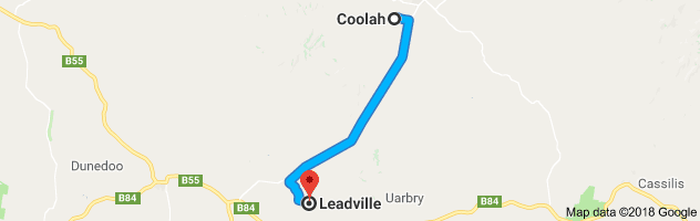
Drive to the small hamlet of Leadville by continuing down the main street in a southerly direction. On the outskirts of town on your right and well off the road, can be seen large sheds that comprised the Coolah Sawmill, which closed when the Warung State Forest was turned into a National Park. On the left, you can see some concrete remnants of the pump station where the steam rail engines were refilled with water. Just before you exit town, on your right is the impressive sandstone Coolahville property.
A few kilometres out of town is the Three Rivers Recreation Ground on your right that hosts many sporting events, particularly horse sports as well as the local music festival.
On this drive down the Coolah Valley, you will pass through fertile farming land. An option now is to turn left on Orana Road towards the Coolaburragundy River Crossing. Note that Orana Road is an unsealed road. Do NOT attempt this crossing in times of flood. Follow the road as it passes farming flats, once the site of a subdivision intended to support a government butter factory, until it joins Moorefield Road where you turn right, cross the disused railway line and rejoin the main road heading south. Turn left.
If you decide not to take the Orana Road turnoff you will come to Narangarie Road. Here you can turn right and approximately 3km in, on the right, is the Narangerie Leaf Fossil Bed where you can fossick for fossils. When you’re done, retrace your steps back to the main road and turn right.
Shortly after the Narangarie Road turnoff, is the location of Hannah’s Bridge on your left. A settlement was formed in this area as it was close to water and one of the few areas not taken up by William Lawson. First called “Benana Plains”, its name continued to change, being “Coolah Road”, “Coolah Bridge” and in the 1920s “Hannah’s Bridge”, named after the Hannah family who had lived in the area from the 1860s. Hannah’s Bridge had some claim to fame through their football team, known as the Greens. Often made up of cousins, the team won 95% of their matches and played as far afield as Sydney.
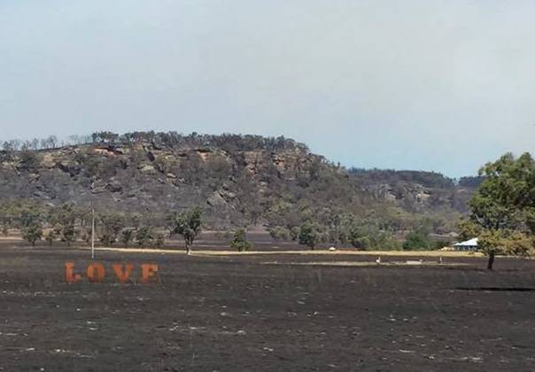
Continuing down the Dunedoo Road, you will come to the hamlet of Leadville. The town was a private village that began in 1891 to support the local mining industry. In 1887 Tommy Governor (father of the bushranger Jimmy Governor), found some silver ore that he took to nearby Pine Ridge Station and the Mt Stewart Silver Mining Company was formed in 1888. In the first 14 months the mine yielded around 300,000 ounces of silver and over 1500 tons of lead, employing hundreds of men. Its relatively remote location and dropping returns meant the mine closed in 1893. There have been a few attempts at further mining, the last being in the 1950s. In 1966 the government stated that the area was practically worked out although exploration licences are still held in the area.
A sleepy hamlet now, Leadville did once have a post office, telegraph office, police station, general store, two churches, two hotels and a hall. The hall is still used for local functions and events. The current hall was built in 1935 by the community, replacing the original hall that was built in 1910.
Journey time is approximately 27min / distance 32km, one way.
A few kilometres further on is the location of Denison Town which was once a busy community although nothing remains apart from the Pioneer Cemetery which contains over 50 burials from 1858 to 1911.
More history on Hannah’s Bridge, Leadville and Denison Town can be found in the book “Around the Black Stump” by Roy Cameron, a copy is available to view in the Coolah Library.
To download this drive in PDF format, please click here: http://coolahnsw.com.au/LEADVILLE%20DRIVE.pdf